On Sunday, my friends and I planned for a very early ride since temperatures were forecast to be in the high 90's or 100's. So, as I'm getting ready for the ride, I went out to my driveway to pick up the paper (gotta read my funnies first thing in the morning), and ash was everywhere. I noticed that the ash looked like the remainder of brush, so I immediately scanned the mountains for smoke, but didn't see any. I went back inside, and scanned the online news for headlines: Brushfire in Sierra Madre, 100 homes evacuated at 11 PM Saturday night. Whoa. I made a mental note to let the other guys know that we would not be going east today.
When we met up for the ride start, my friend Richard had all the news from yesterday. He had actually seen the smoke develop Saturday afternoon, but it didn't seem to be that serious. According to the news, the wind picked up after sunset, requiring the evacuation of the homes and the Boy Scout camp at Chantry Flats. And truly, the fire was worse that morning: whenever we crossed an open intersection, we got a face full of ash from a western blowing wind. Since we weren't going east, we went south and west, picking up another friend near South Pasadena, and then off towards La Cañada via the Rose Bowl. The light was eerie as we pedaled north of the Bowl, since a huge smoke cloud began to obscure the sun. We looped back down to South Pasadena and rested a bit. Interestingly enough, while sipping good iced coffee at Kaldi's, we remarked that that the best thing for Hillary Clinton and John McCain would be more Jeremiah Wright nonsense. Ouch for Obama yesterday, huh? Then it was time to climb back up the foothills to Pasadena to beat the heat.
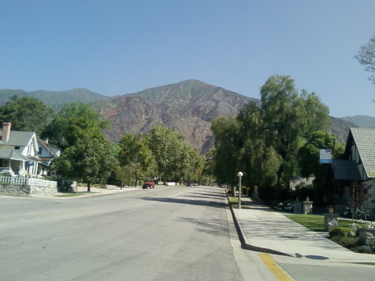
Today, with news that the evacuated residents were allowed back home, and not seeing any new smoke (or smelling any!), I decided to take a little look, a little see at the hills of Sierra Madre.

Hazy view of the Sierra Madre hills from Sierra Madre Boulevard.
I turned up Baldwin, and got the clearest view of the fire damage and how close the fire actually got to the homes.
Burned out ridges north of Baldwin Avenue.
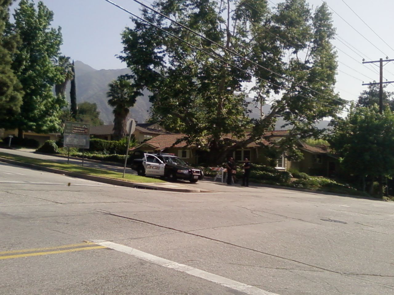
I turned right on Grandview, which happened to be the furthest north that non-residents could go up into the Sierra Madre foothills. Every intersection had at least one police car and barricades, making sure you showed your identification to let you onto the streets. The police were pulled from all the foothill towns. I saw Glendora, Arcadia, San Marino, Pasadena, and Monrovia. Today would be a good day for daylight neighborhood invasion robberies in those smaller towns, just sayin'. In fact, only one block north of Grandview on Santa Anita is the start of Santa Anita Canyon Road, which leads to the Boy Scout camp and all the major trail heads. Of course, that was blocked too.
The intersection of Grandview and Santa Anita: yes, it really is as steep as it looks.
You can't see it from the picture of the burned out ridges above Baldwin, but I saw a line of firefighters continuing to dig new firebreaks and tamp out hotspots. If you can make it out, one of the ridges is red-colored from the fire retardant that was dropped on it yesterday. I was out in east Pasadena yesterday afternoon, and I saw the big jets actually dropping the retardant on that smoking ridge. The firefighters did an awesome job keeping homes safe, and making sure the fire stayed in the hills, instead of beginning to jump from house to house. Heartfelt thanks go to them for their effort and dedication.
No comments:
Post a Comment
Please don't comment on posts more than 4 years old. They will be deleted.